
MacKenzie River Bridge Replacement
Location: Cabot Trail, Nova Scotia, Canada
Client: Parks Canada
Duration: 2016
Key Staff: Michael MacDonald, Tim Jordan, Kevin MacDonald, Cory Baker
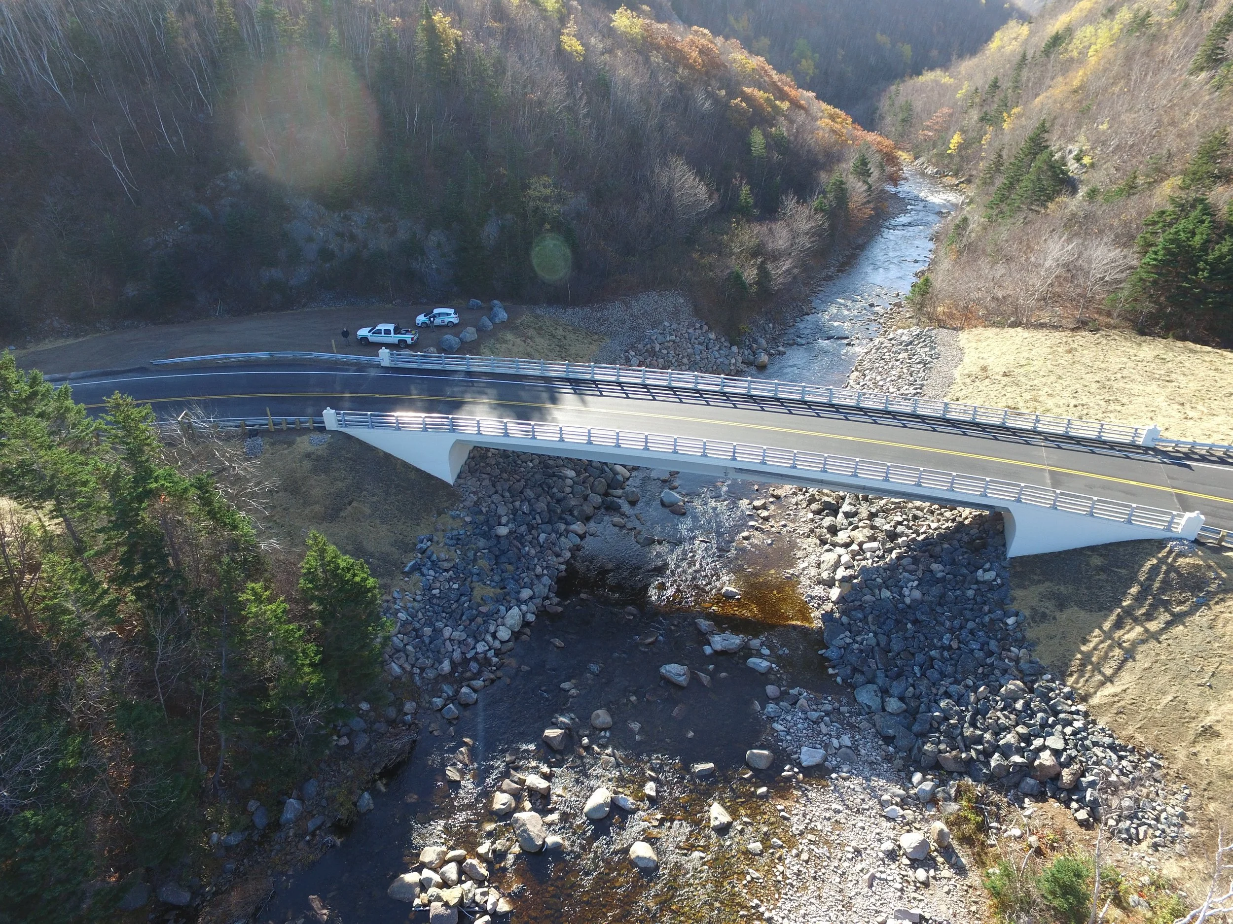
Image of the completed Mackenzie River Bridge, taken from a helicopter over the Cabot Trail, 2016.
Project Description
The roadway near the MacKenzie Brook Bridge site consisted of small radius curves and steep grades on both approaches to the structure. The posted speed was 30 km/h. The horizontal curve radii ranged from 36 m to 75 m. The bridge was located on a short tangent, cross slope at normal crown, with curves starting a very short distance from the bridge ends. This resulted in rapid cross slope transitions to superelevated sections. In 2016, following the decision to replace the existing bridge, Harbourside Transportation Consultants was tasked with the design for approaches to the new bridge.
Harbourside’s Role
Harbourside Transportation Consultants completed the design of the vertical and horizontal alignments, from initial concept layouts through to detailed design and tender, for the new approaches to the MacKenzie Bridge Replacement.
The new bridge needed to be constructed while maintaining traffic flow through the area, utilizing the existing bridge. The existing roadway geometry did not meet current guidelines, as identified in the Geometric Design Guide for Canadian Roads by the Transportation Association of Canada (TAC). This included both horizontal and vertical geometry and superelevation.
The objective of the alignment design was to be able to construct the new bridge while maintaining traffic on the existing structure and improving the geometry on the roadway approaches. Two main preliminary options were developed; a North alignment and a South alignment, both with design speeds of 40-km/h. The North alignment was recommended as it provided a larger radius curve of 60-m which replaced the three existing curves of radii 175-m, 36-m and 50-m. The curve was fully superelevated at 6%, including the new bridge. The North realignment was predominantly in-fill with minimal excavation. This option required borrow from off-site. Similarly, the South realignment was mostly in-fill, but with some rock cuts. The length of new roadway was similar for both options. A preliminary cost estimate for the construction of approach roadways was provided.


Unique Challenges
The existing curves did not provide adequate tangent lengths between the curves, thus replacing the existing bridge at its’ current location was not recommended. Also, construction of a temporary structure to accommodate traffic while the existing bridge was being replaced was deemed not to be a cost-effective alternative.
Social Impact
By updating the approaches of the Mackenzie River Bridge to meet modern guidelines, the new bridge is much safer than its predecessor. This modernization also allows for smoother flow of traffic and increased visibility.