
CCG SAR Geotechnical & Servicing Study
Location: Freeport, Long Island, NS
Client: PSPC
Duration: 2024
Key Personnel: Todd Menzies, Dani Stuart, Riley Guest
Project Description
The Canadian Coast Guard (CCG) propose to construct a new CCG Search and Rescue Station (CCG-SAR) at the Freeport (South Cove) Small Craft Harbour (SCH) on Long Island, Digby County, NS. The current SAR station is located across Grand Passage on Brier Island near the Grand Passage Lighthouse. As part of the planned improvements, the new SAR station will be located within Freeport, and this new site will allow for larger vessels than what is currently possible at the existing station. The new site will also offer upgraded services and a larger dedicated berth.
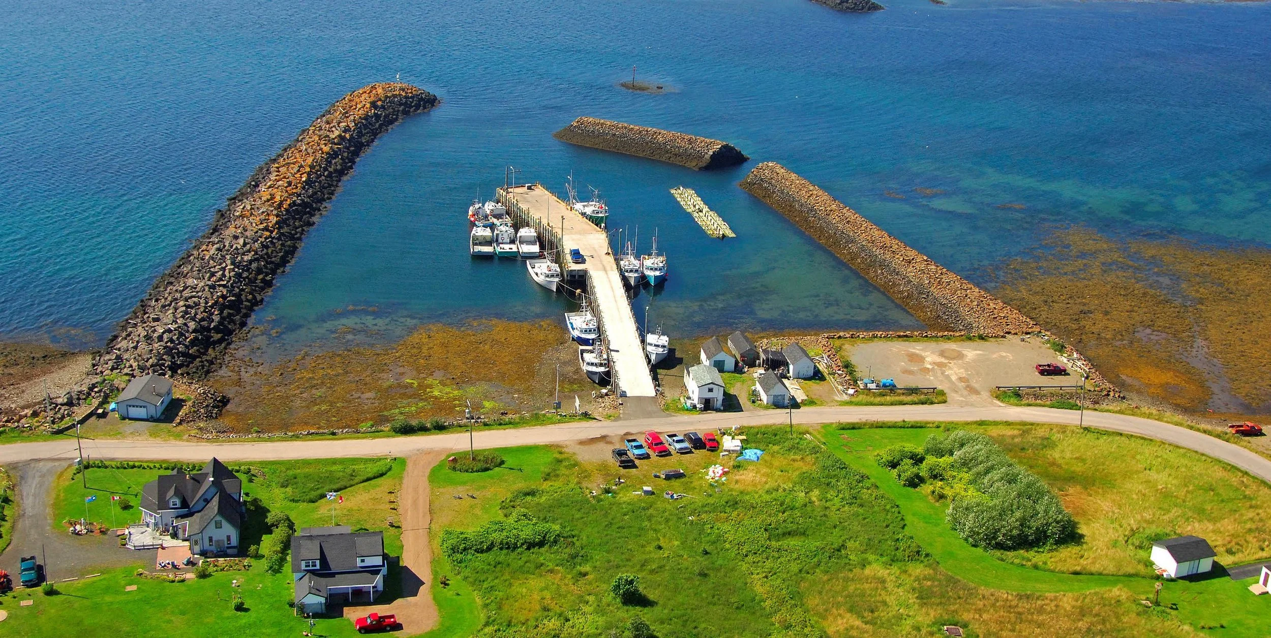
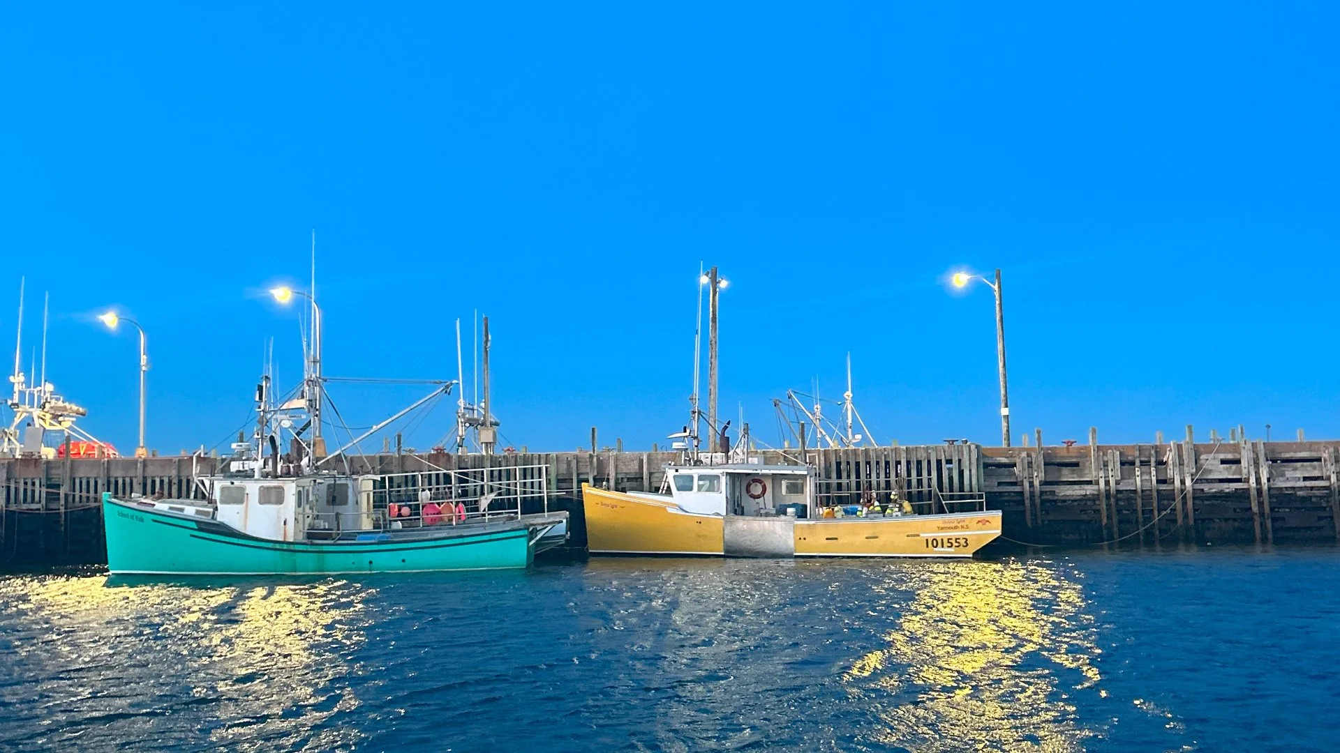
The current concept layout will use the existing infrastructure (with some improvements) at the Freeport SCH. This is an active harbour that services various commercial fishing vessels throughout the year. The existing structures at the SCH include a cribwork wharf protected by south and north breakwaters. There is also a small upland service area in the eastern corner of the basin.
To support the planning and design of the new CCG-SAR, Harbourside was engaged to conduct a geotechnical investigation and site servicing study. This geotechnical investigation was to characterize the subsurface conditions at the site. As for the Site Servicing Study, the intent was to identify a preferred option for water and wastewater servicing to be selected for further detailed design.


Harbourside’s Role
As part of this work the Harbourside team, in consultation with the Departmental Representative, completed a detailed review of the available information, and prepared plans for completing both the geotechnical investigation and site servicing study. Harbourside acted as the prime consultant and managed all aspects of this work. As such, Harbourside was responsible for arranging and preparing all permits, utility clearances, and other requirements necessary for site access to conduct the geotechnical and site servicing field investigations. This included sending out a notice to mariners before mobilizing to complete the marine-based work and arranging berthing for the marine plant throughout the program.
Geotechnical Investigation
The aim of the investigation was to provide subsurface information to allow design of site development. The geotechnical investigation included both a land-based portion of four test pits, a marine-based portion of nine boreholes, and one dynamic cone penetration test. To ensure accuracy, all borehole locations were surveyed with a construction-grade GPS system using real-time kinetic correction. The field investigation was closely managed by Harbourside’s experienced field technician, project engineer, and project manager to ensure that it was adapted in real time to suit the conditions encountered.
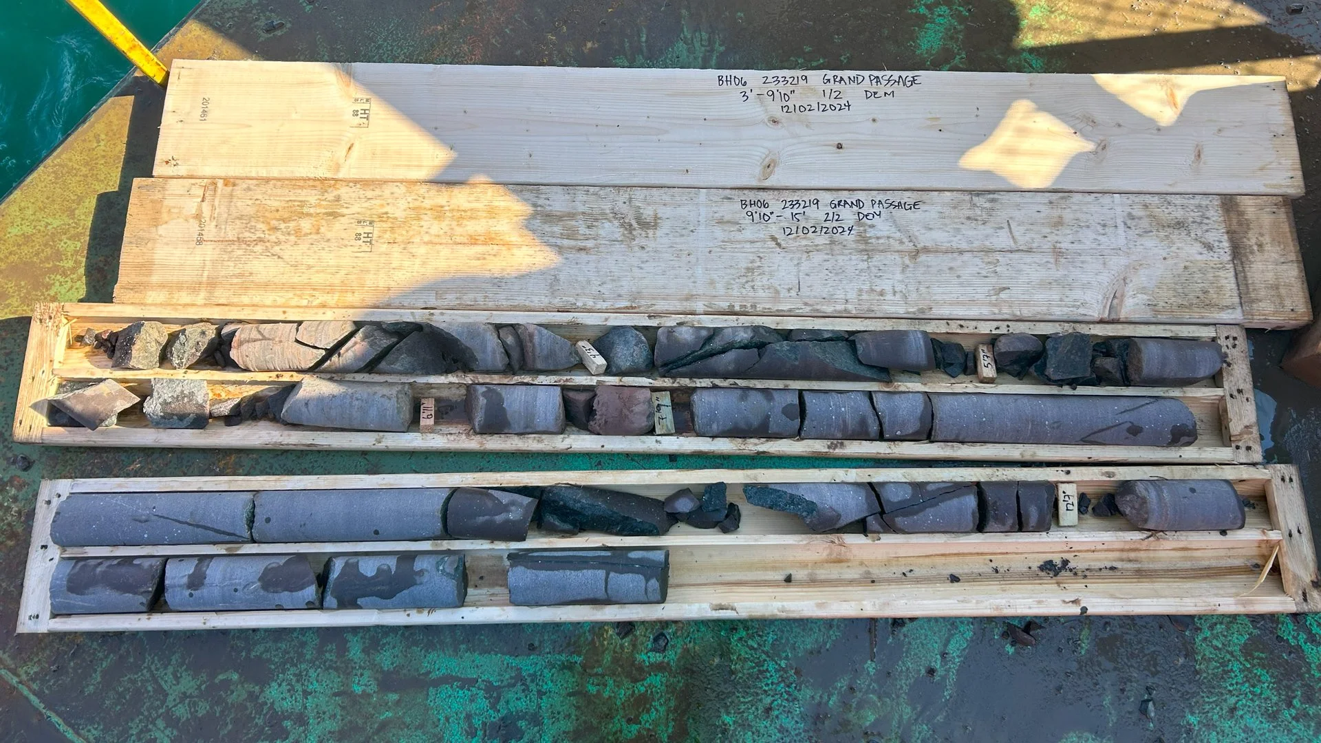
Samples obtained during the investigation were labelled with the project name, borehole name, sample number, and depth of the sample. They were transported for testing to Harbourside’s laboratory in Dartmouth. The laboratory analyses included classifying soil in accordance with the Unified Soils Classification (USCS) system; determining the engineering properties of the soil by correlations with the soil classification and index properties (i.e. water content, particle-size analyses, and Atterberg limits) and inferred density (from SPT testing). Specific testing was also conducted on any soft materials encountered to indicate their compressibility and strength properties. The strength of the intact rock mass was determined by laboratory UCS testing.
Site Servicing Study
This survey, completed by a third party, assessed and further developed feasible concept options to service the site. Work included a site assessment of nearby prospective properties with regards to their suitability to house a conventional water supply well and/or septic wastewater system. The site assessment considered environmental, legal, or regulatory constraints; land features including topography and vegetation; hydrogeological setting; impacts to the community and neighbouring properties; infrastructure requirements and associated costs; community interest/approval (based on interview); and the estimated effect on property values. Field and laboratory testing completed included yield testing of existing wells (if accessible), installation and monitoring of test wells, water quality testing, completion of test pits (or boreholes) at the proposed disposal field locations. Various options were considered, and the preferred option was presented to the client.
Unique Challenges
This project involved the consideration of multiple stakeholders, beyond simply the needs of the client. Environmental factors, and consultation with the community had to be factored into the evaluation process, in addition to the impacts on the local fishing industry. The geotechnical investigation and site service study had to work holistically to inform the preferred option.
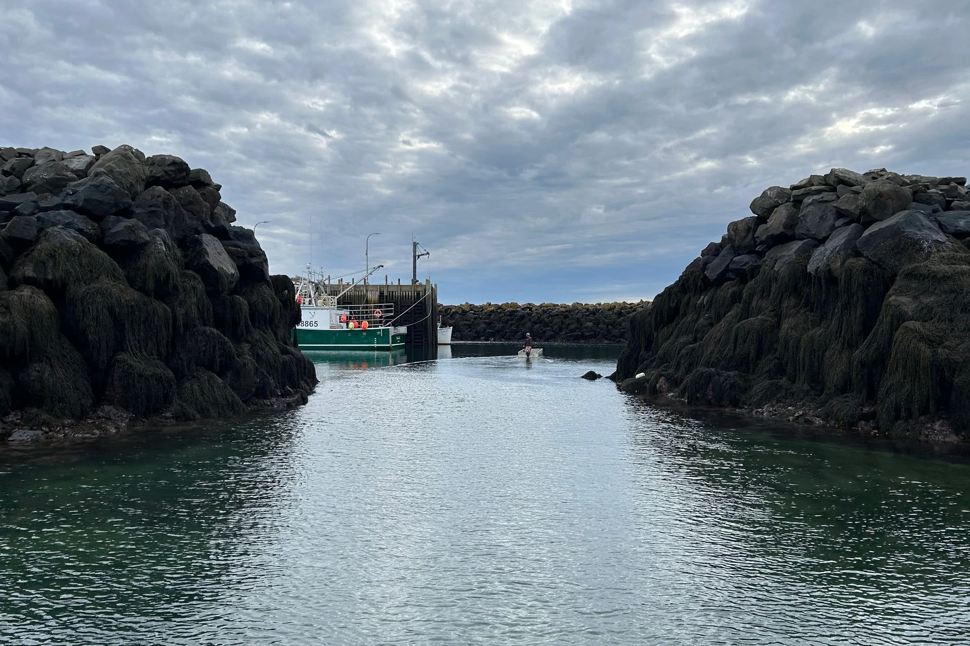
In addition to the social aspect, in-water work comes with an array of potentially challenging situations. Weather and tidal forces, seafaring traffic, and environmental regulations have to be properly managed in order to complete an effective geotechnical investigation.
Social Impact
A new search and rescue station capable of berthing larger vessels will be critical to improving Canadian Coast Guard operations within the area. The placement of a new facility within Freeport also helps to make it marginally more accessible. Overall, this project represents a dedication towards improved safety and efficiency in operations for the Canadian Coast Guard, and Search and Rescue within the area.