
Bedford West Sub Area 10 Traffic Study
Location: Halifax, NS, Canada
Client: DesignPoint Engineering & Surveying
Duration: 2015
Key Staff: Michael MacDonald, Robin King, Courtney McCarthy
Project Description
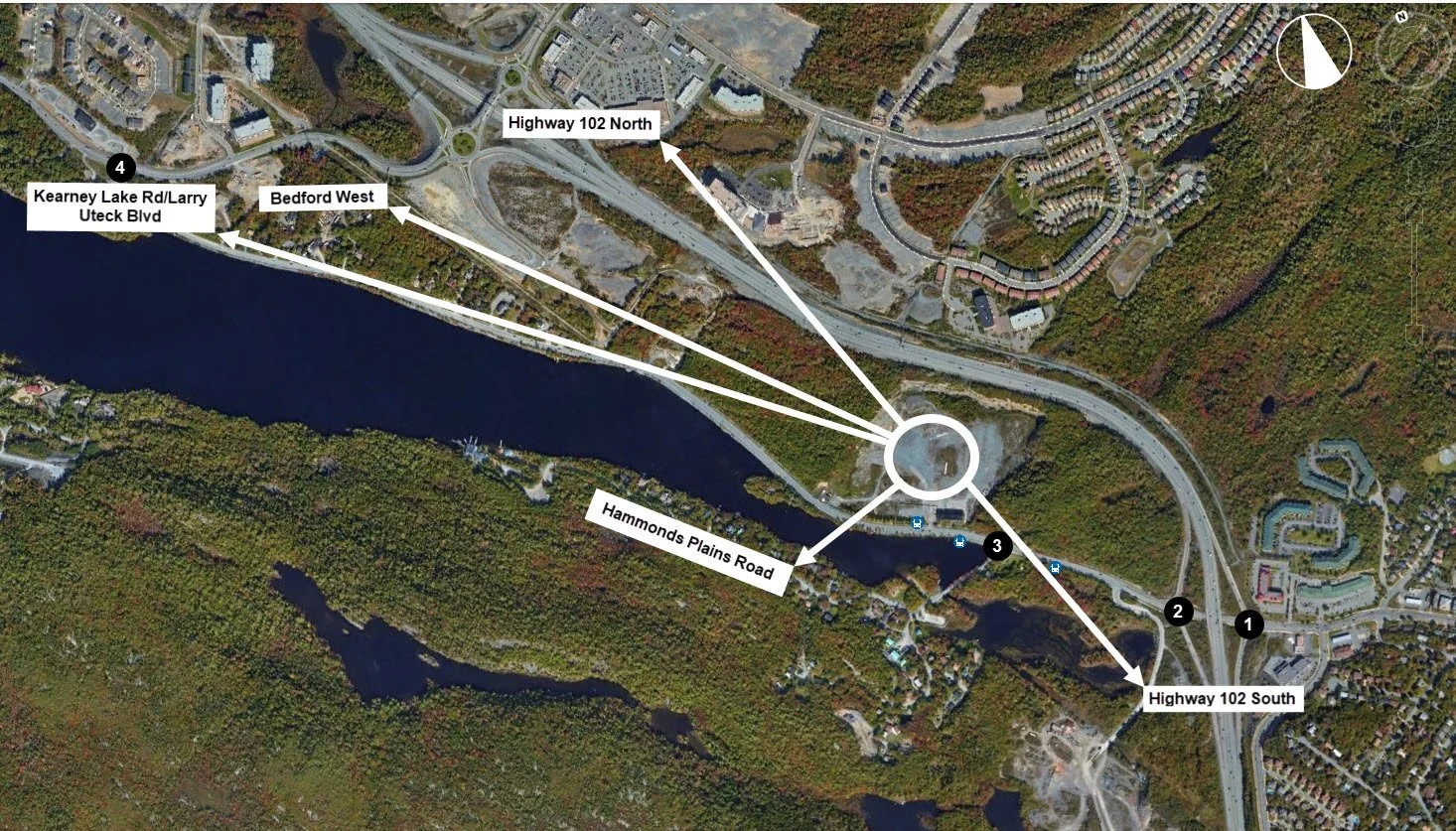
Harbourside Transportation consultants completed a traffic impact study as part of the development application for Bedford West Sub Area 10. This was to quantify the transportation impacts of the proposed roundabout development. The study evaluated traffic operations at Highway 102 and Kearney Lake Road interchange currently controlled by two signalized intersections that were operated by the same traffic controller. In all, the proposed development included 62.1 acres of residential development, 4.1 acres of commercial development, a community center of approximately 7,500 sq. ft. and a trail corridor. The total development thereby spanned 74.1 acres.

The study identified existing operational problems at the Kearney Lake Road interchange and projected that with background traffic growth alone, the southbound off-ramp would exceed capacity during both peak hours by 2031. The study concluded that improvements were required at Highway 102 and Kearney Lake Road interchange to accommodate background traffic growth and the full build-out of the Bedford West Sub Area 10 development. The study recommended that the two signalized intersections be converted to roundabouts to accommodate long-term growth at the interchange.
Harbourside Transportation Consultants also reviewed the proposed access points along Kearney Lake Road for stopping sight distance, minimum spacing between intersections and number of accesses per property. HTC verified that the proposed design met Halifax Regional Municipality Guidelines. We also recommended cross-site connectivity to allow for internal trips and minimize the congestion along Kearney Lake Road.
Harbourside’s Role
As transportation engineers, the objectives of the study included establishing several points of reference.
An assessment was conducted of the existing road network and intersections during peak traffic on a typical weekday. This included both AM and PM traffic.
Harbourside established the trip generation rates for the proposed development.
An assessment of the anticipated traffic conditions of the study area was conducted, for both streets and intersections. This had to be done with the proposed development reflecting normal growth rates to the full build-out.
The impacts of the proposed development on the study area were identified. This included both streets and intersections, and both the AM and PM peak traffic periods.
Harbourside also identified any required improvements to the study area streets and intersections that may be necessary to accommodate the proposed development.
Unique Challenges
Different property owners had to be consulted during the study. Many had proposed different property development plans that had to be reviewed and considered at various stages of the project.
In addition, due to the nature of the site, establishing efficient trip distribution was critical. Correctly routing between the proposed development with a new interchange site was key.
Social Impact
Planning cities and roadways in preparation for the future is key. With the previous 102 off-ramp calculated to reach or exceed capacity before 2031, it was important to update the roadways and intersections in the area. Future-proofing infrastructure is essential in keeping a modern city (and its traffic) flowing smoothly.